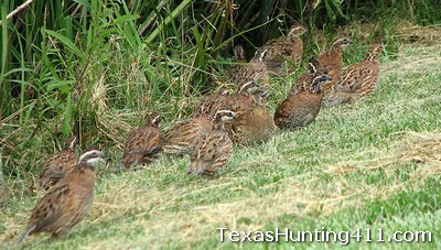
Go back in time about 50 years ago and the “old timers” will tell you that bobwhite quail were an abundant species in Texas. This secretive upland game bird thrived during a time when good quail habitat was being dotted with new, productive farming practices. Little did they realize, the good bobwhite quail hunting and bird population in Texas was riding on the coattails of the disappearing native bunch grasses that these seed-eating birds so desperately need. Not so much for food, but more importantly for nesting and overhead protective cover while traveling.
Quail Surveys in Texas
Texas Parks and Wildlife (TPWD) designed the roadside quail survey in 1976 to track quail production trends at only the statewide and ecoregion spatial scales. The 20 mile routes were randomly assigned and most counties have either zero or one route. Staff runs each route only once during the first two weeks of August. Biologists record the number of singles, pairs, coveys, and number of quail within coveys for each quail species by 1 mile increments. The relative age of broods also is recorded.
Due to legislatively mandated budget cuts in 1988, all routes were discontinued in the Pineywoods, Post Oak Savannah, Blackland Prairies, and High Plains ecological areas. Certain quail routes in other ecological areas also were discontinued at this time. In 1993, many High Plains routes were once again reinitiated.

Roadside-Route Scale for Quail Surveys
Route counts are not replicated within a given year. For this reason, the number of quail observed during any single observation is not necessarily indicative of quail abundance in the general area of the route. For example, when routes are run on consecutive days it is common to see 3 birds one day and 30 the next. This occurs because quail often occur in groups (coveys). In reality, the observer just happened to see a pair and a single on the first day, and two coveys the next. For this same reason, observing 3 quail one year and 30 the next on a single route run once annually does not mean there are more quail in the area during year two. If the State wanted to track trends in quail abundance associated with a single route, they would have to run that route 20 to 30 times during the month of August.
Quail Surveys at the County Scale
Similarly, if one wanted to understand quail abundance trends in individual Texas counties, 20 to 30 routes scattered randomly through each county would be required. In that way, routes would be representative of the habitat types in the county. Additionally, enough routes would be used to avoid the problems associated with running routes only once (see above). Alternatively, one could run fewer routes multiple times. Data collected at this scale would be valuable to hunters, but the Department does not require such information for quail management purposes or the regulatory process. At any rate, TPWD does not have the resources to run thousands of routes.
Quail Surveys at the Ecological Area Scale
Instead, TPWD made the decision in the late 1970s to run 20-30 randomly chosen routes in each ecological area. By having several routes in a given ecoregion, the fact that any given route might have 3 quail one day and 30 the next does not matter—you see a hump-shaped distribution of quail abundance for the region. By chance, a few unusually low and high values are returned, but most observations occur somewhere in the middle. In this way, TPWD obtains reliable information on quail trends at this spatial scale. These data are then combined and used at the statewide scale. An independent perspective can be obtained via hunter surveys. Approximated 90% of the variation in the number of northern bobwhite and scaled quail bagged annually can be explained by the mean number of quail observed per survey route in a given ecological area.
Unfortunately, many folks have incorrectly assumed that data collected to provide information at the scale of ecoregions also are directly applicable at finer spatial scales (counties, habitat associated with a given route). For reasons described above, this is not so. This issue has confused the public and many wildlife biologists alike. One can glean only limited reliable information from these data at spatial scales finer than an ecoregion level.
Quail Surveys: Quail Abundance Data at Fine Scales
Quail hunters can obtain useful anecdotal information on quail abundance for counties or groups of counties from the TPWD District Leader responsible for that area. These individuals have their thumb on quail abundance in their District and will gladly share this knowledge with you. To find the District Leader responsible for your area of interest, please call TPWD Wildlife Information at 800-792-1112.
Without a doubt, the best way to obtain reliable data on quail abundance for individual pastures and ranches is to implement quail surveys designed for this purpose. Site-specific data will help with estimating numbers on on ranches and can help with quail hunting strategies. Numerous wildlife biologists are able and willing to help design and implement survey protocols to meet specific needs. Wildlife extension specialists from universities or TPWD can help. Additionally, private wildlife management consultants abound. Lastly, several excellent publications outline these survey methods. For example, see Dr. Fred Guthery’s “Beef, Brush, and Bobwhites: Quail Management in Cattle Country” (1986, CKWRI, Texas A&M University, Kingsville, pp. 132-145).