Brazos Bend State Park Hunting


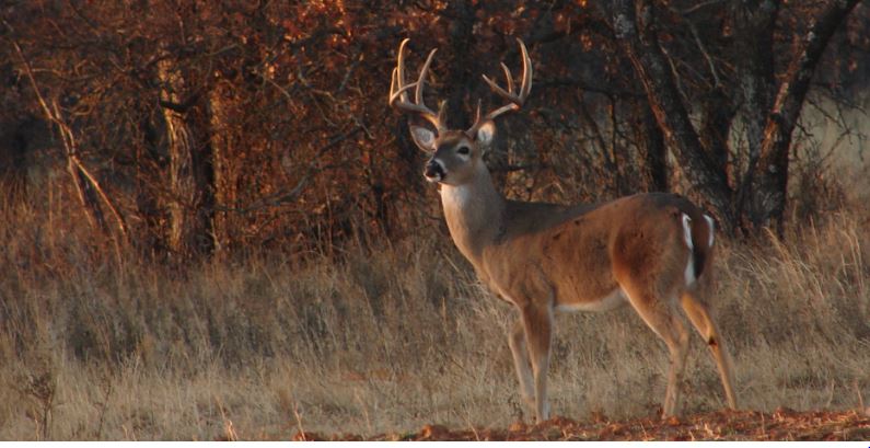
The Brazos Bend State Park is 4,975 acres of habitat found in Fort Bend County. The property is located about 20 miles southeast of Richmond, Texas. Most of the state park is in the Brazos River floodplain and is dominated by bottomland habitat. Because this is a water-dominated area in a humid part of the state, waterproof footwear is recommended for all public hunters.

Brazos Bend State Park provide good opportunity for public hunting, especially for white-tailed deer. The hunter check station is located at the group banquet hall in the interior of the park. Hunters may use the park’s water and electric campsites and shelters overnight, for which the regular use fee is charged. Call the park at 979-553-5101 for additional information on their public hunting opportunities.


Muse Wildlife Management Area (WMA)

The Muse Wildlife Management Area (WMA) is managed by Texas Parks and Wildlife Department and was established in 2006. The management are comprises 1,972 acres of native habitat in Brown County, Texas. The Muse WMA is located about 15 miles Northeast of Brownwood and the headquarters is north of F.M. 1467 on CR 478. The operation of Muse WMA includes the development and management of wildlife habitats and populations of indigenous and migratory wildlife species, such as white-tailed deer, wild turkey and mourning dove.

The Muse WMA provides areas to demonstrate habitat development and wildlife management practices to landowners and other interested groups. The WMA can be used to develop new techniques for managing wildlife populations and habitat through on-the-ground research designed for local issues and conditions. In addition, the management area will be used to provide public hunting and appreciative use of wildlife in a manner compatible with the resource.

The Muse is considered to be in the southern Cross Timbers and Prairies ecoregion, although the majority of the area is encompassed by a large ridge of limestone rising above the prairie floor. Diverse topography and soil types are conducive to a variety of plants types and is generally dominated by oak-juniper woodlands, post oak-mesquite flats and small creeks with hardwood bottoms.


No camping or fires area allowed on the management area. Camping facilities are available at nearby Lake Brownwood State Park (325-784-5223). All hunters are required to sign in at the check station when entering or leaving the WMA. Hunting is by assigned blind and hunters will take their vehicles to the hunting blind assigned. For more information on the Muse WMA, contact the TPWD Brownwood office at 325-643-5977 or 325-203-6926.

South Llano River State Park Hunting

The South Llano River State Park (SP) is only 524 acres, but it holds a lot of wildlife thanks to the wooded bottomland habitat that comprises almost all of this area. This makes for great white-tailed deer hunting, turkey hunting, and exotic hunting. The park is located in Kimble County on the South Llano River about 5 miles southwest of Junction, Texas. The South Llano River SP has about 2 miles of river frontage, a large pecan bottom next to the river, and typical Hill Country habitat found in the more upland areas.

Animals found within the South Llano include white-tailed deer, squirrel, jackrabbit, javelina, fox, bobcat, cottontail, and armadillo. Several exotic ungulate species such as axis deer, fallow deer, and even blackbuck antelope are also often seen using the wildlife habitat found in the park. And believe it or not, the bottomland area found within the park represents one of the oldest winter turkey roosts in the Hill Country of Texas. The roosting area is closed to park visitors from October through March.

The South Llano River SP adjoins Walter Buck Wildlife Management Area, which also provides public hunting opportunities. The park was donated to Texas Parks and Wildlife Department in 1977 and was opened to the public in 1990. Activities outside of the Special Permit hunt periods include camping, picnicking, canoeing, tubing, swimming, fishing, hiking, mountain bike riding, and bird watching. For more information on public hunting at South Llano River SP call 325-446-3994.

Big Lake Bottom Wildlife Management Area (WMA)

The Big Lake Bottom Wildlife Management Area (WMA) is owned and operated by the Texas Parks and Wildlife Department (TPWD) and provides public access and public hunting opportunity. The 2,870-acre management area lies adjacent to the Trinity River and is located about 15 miles southwest of Palestine, Texas, in Anderson County. It was purchased by TPWD to preserve the rapidly disappearing Post Oak Savannah’s bottomland hardwood habitat.

The Big Lake Bottom WMA is not totally contiguous, but fragmented by private tracts of land. It is accessible from county roads at two locations. The topography, soil types, and vegetation of the area are representative of the Post Oak Savannah river bottoms. Soils are of poorly drained clays and flood regularly. Since the terrain is flat and lies within the river’s flood plain, the area is often covered by shallow slow moving floodwaters.

The area is normally inaccessible several times a year for extended periods due to high water or wet soil conditions. Over 90 percent of the management area is bottomland habitat of mature hardwood timber. Portable deer stands that do not damage trees are encouraged and will increase hunter success. Portable blinds are not available at the area, but one primitive campground is available to hunters and permit holders.

Because Big Lake Bottom WMA has very limited access and long distances to hunting compartments, often 2 to 3 miles, use of ATVs and other off road vehicles is strongly encouraged. ATVs must be operated in accordance with state law regarding the use of ATVs on public land. Caution should be taken during public hunting and rainy weather as this area is prone to flooding. In fact, high water may result in cancellation of scheduled hunts on short notice.


Principal wildlife species found on Big Lake Bottom WMA include white-tailed deer, feral hog, ducks, mourning dove, fox squirrel, gray squirrel, bobcat, raccoon, skunk, armadillo, coyote, gray fox, and many species of reptiles and migratory birds. Call the WMA headquarters at 903-389-7080 for more information on access and their public hunting programs.

Quail Hunting in Texas: Bobwhite Quail Surveys Helpful

Go back in time about 50 years ago and the “old timers” will tell you that bobwhite quail were an abundant species in Texas. This secretive upland game bird thrived during a time when good quail habitat was being dotted with new, productive farming practices. Little did they realize, the good bobwhite quail hunting and bird population in Texas was riding on the coattails of the disappearing native bunch grasses that these seed-eating birds so desperately need. Not so much for food, but more importantly for nesting and overhead protective cover while traveling.

Quail Surveys in Texas

Texas Parks and Wildlife (TPWD) designed the roadside quail survey in 1976 to track quail production trends at only the statewide and ecoregion spatial scales. The 20 mile routes were randomly assigned and most counties have either zero or one route. Staff runs each route only once during the first two weeks of August. Biologists record the number of singles, pairs, coveys, and number of quail within coveys for each quail species by 1 mile increments. The relative age of broods also is recorded.

Due to legislatively mandated budget cuts in 1988, all routes were discontinued in the Pineywoods, Post Oak Savannah, Blackland Prairies, and High Plains ecological areas. Certain quail routes in other ecological areas also were discontinued at this time. In 1993, many High Plains routes were once again reinitiated.

Quail Surveys and Quail Hunting in Texas

Roadside-Route Scale for Quail Surveys

Route counts are not replicated within a given year. For this reason, the number of quail observed during any single observation is not necessarily indicative of quail abundance in the general area of the route. For example, when routes are run on consecutive days it is common to see 3 birds one day and 30 the next. This occurs because quail often occur in groups (coveys). In reality, the observer just happened to see a pair and a single on the first day, and two coveys the next. For this same reason, observing 3 quail one year and 30 the next on a single route run once annually does not mean there are more quail in the area during year two. If the State wanted to track trends in quail abundance associated with a single route, they would have to run that route 20 to 30 times during the month of August.

Quail Surveys at the County Scale

Similarly, if one wanted to understand quail abundance trends in individual Texas counties, 20 to 30 routes scattered randomly through each county would be required. In that way, routes would be representative of the habitat types in the county. Additionally, enough routes would be used to avoid the problems associated with running routes only once (see above). Alternatively, one could run fewer routes multiple times. Data collected at this scale would be valuable to hunters, but the Department does not require such information for quail management purposes or the regulatory process. At any rate, TPWD does not have the resources to run thousands of routes.

Quail Surveys at the Ecological Area Scale

Instead, TPWD made the decision in the late 1970s to run 20-30 randomly chosen routes in each ecological area. By having several routes in a given ecoregion, the fact that any given route might have 3 quail one day and 30 the next does not matter—you see a hump-shaped distribution of quail abundance for the region. By chance, a few unusually low and high values are returned, but most observations occur somewhere in the middle. In this way, TPWD obtains reliable information on quail trends at this spatial scale. These data are then combined and used at the statewide scale. An independent perspective can be obtained via hunter surveys. Approximated 90% of the variation in the number of northern bobwhite and scaled quail bagged annually can be explained by the mean number of quail observed per survey route in a given ecological area.


Unfortunately, many folks have incorrectly assumed that data collected to provide information at the scale of ecoregions also are directly applicable at finer spatial scales (counties, habitat associated with a given route). For reasons described above, this is not so. This issue has confused the public and many wildlife biologists alike. One can glean only limited reliable information from these data at spatial scales finer than an ecoregion level.

Quail Surveys: Quail Abundance Data at Fine Scales

Quail hunters can obtain useful anecdotal information on quail abundance for counties or groups of counties from the TPWD District Leader responsible for that area. These individuals have their thumb on quail abundance in their District and will gladly share this knowledge with you. To find the District Leader responsible for your area of interest, please call TPWD Wildlife Information at 800-792-1112.

Without a doubt, the best way to obtain reliable data on quail abundance for individual pastures and ranches is to implement quail surveys designed for this purpose. Site-specific data will help with estimating numbers on on ranches and can help with quail hunting strategies. Numerous wildlife biologists are able and willing to help design and implement survey protocols to meet specific needs. Wildlife extension specialists from universities or TPWD can help. Additionally, private wildlife management consultants abound. Lastly, several excellent publications outline these survey methods. For example, see Dr. Fred Guthery’s “Beef, Brush, and Bobwhites: Quail Management in Cattle Country” (1986, CKWRI, Texas A&M University, Kingsville, pp. 132-145).
Garner State Park Hunting

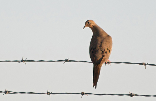
The 1,484 acre Garner State Park is operated by Texas Parks and Wildlife Department (TPWD) and is located in the Texas Hill Country in Uvalde County. The park participates in TPWD’s public hunting lands program and usually offers hunting for white-tailed deer and other exotic deer species such as axis and fallow. The park is located 31 miles north of Uvalde and 7 miles north of Concan on U.S. Highway 83 to FM 1050.

Hunters from across the state know that Garner State Park hold lots of wildlife, so it is a coveted hunting area for public hunters. The area surrounding the park is also known for great whitetail hunting, turkey hunting, and dove hunting.

Hunting at Garner State Park

Because the park is located along the Frio River, this area usually serves as a haven for for animals located in this bottomland-dominated habitat, except during the Special Permit (draw) hunts held each fall.

The habitat found within the park consists of steep limestone hills and dense juniper and oak woodlands. The river is the dominant feature running through the park, but game will “sink” into this area from the surrounding uplands. Every part of this park offers great public hunting for native and non-native deer species.

It is also a great place to vacation and relax outside of hunting season. Camping within Garner State Park will be available for the hunters during hunts. For information of public hunting or Garner State Park, contact the park at 830-232-6132.

Deer Management Permit (DMP) for Whitetail Deer in Texas

The Deer Management Permit

The Deer Management Permit (DMP) is a permit issued by Texas Parks and Wildlife Department (TPWD) that allows for the more-controlled breeding of wild deer. The DMP authorizes owners of high-fenced properties to temporarily detain white-tailed deer in breeding pens located on the property for the purpose of natural breeding. Deer may not be detained for purposes that do not include natural breeding, such as the “soft release” of bred TTT deer.

Landowners can use DMP’s to “trap” deer within a portion of their ranch, typically 5 to 60 acres, to facilitate breeding using a specific whitetail buck, even breeder deer that are placed in the permitted area. All ranch facilities (DMP pastures) must be completed prior to submitting the application and deer management plan to the local TPWD Wildlife Biologist for review and approval. The application and deer management plan must be approved and signed by an authorized TPWD Wildlife Biologist.

The Deer Management Permit (DMP) in Texas

Deer Management Permit Participation & Application

Participation in the DMP program requires a written Deer Management Plan that details the proposed breeding operation. The Deer Management Plan is incorporated into the DMP Application, which can be completed online using the Texas Wildlife Information System (TWIMS). No other forms may be substituted for the Deer Management Plan.

TPWD does require is a non-refundable application processing fee of $1,000. Applications for a Deer Management Permit must be made in consultation with an authorized TPWD Wildlife Biologist. To contact the appropriate TPWD Wildlife Biologist`s in your area landowners should call the Wildlife Division District Leader for their county. Follow this link to select the appropriate county and the District Leader contact information will appear on that page.

Specific Information on the Deer Management Permit

DMP breeding pens/pastures must be between five and 100 acres in size. There may be multiple breeding pens on a property. Up to 20 does and one buck may be detained in each breeding pen. The following types of deer may be placed into the breeding pen: (1) wild deer captured on the high-fenced property, (2) wild unbred deer transported under a valid TTT permit from an approved ranch, (3) deer purchased from a permitted Deer Breeder facility that will be liberated on the property after breeding, and (4) buck deer from a permitted Deer Breeder facility that will be temporarily placed into the pen for breeding and subsequently returned to the Deer Breeder.

Wild unbred deer from the high-fenced property may be trapped and placed in the breeding facility between September 1 and December 14 depending on ecoregion.

Deer Management Pen (DMP) Trapping & Release Dates

Deer may be transported from another ranch directly into DMP pens with a valid TTT permit between October 1 and December 14 depending on ecoregion . Please be advised that neither bucks nor does may not be trapped for purposes of TTT from tracts of land where Deer Management Permit (DMP) deer have been released during the same permit year.

To facilitate release, a minimum of 20 feet of fence or gate must be removed and all supplemental food and water must be removed from the pen for at least 30 days. Pens may contain multiple openings to meet this 20-ft requirement; however, no such opening may be less than 10 feet in width. Each gate or fence opening to facilitate release of deer from the DMP pen must open directly to the pasture from which they were captured (except for deer that entered the DMP facility via TTT permit) and not through another pen. Deer that entered the DMP facility via TTT must be released directly to the release site indicated on the TTT Release Site form, and not through another pen. Deer must be released no later than 45 days prior to the trapping deadline of the subsequent DMP trapping season.

All deer mortalities must be kept in an edible condition and donated to a charitable institution. Accurate records documenting the number and origin of deer in breeding pens must be maintained by the deer management permittee. Deer Management Plan facilities and records may be inspected by an authorized TPWD employee at any time and without warrant.

Chaparral WMA Research Examines Buck Antler Restrictions

The Chaparral Wildlife Management Area is a 15,000 acre state-owned research and demonstration area located in LaSalle and Dimmit counties in the heart of the South Texas brush country. White-tailed deer hunting on the WMA is by lottery special permit drawing. The area has an abundance of mature bucks and is well known by Texas hunters for the quality of its buck harvest. Due to its popularity, the Chaparral WMA receives more than three times as many applications for either sex hunts than any other public hunting area in Texas!

From 1991 to 1994, deer hunters were allowed to harvest one buck. Under these harvest regime hunters most often selected mature bucks exhibiting above average antler development – or high grading of the buck segment of the deer herd. Harvest regulations were modified in 1995 to increase the harvest of bucks with poor antler development. The bag limit was increased to two bucks and a buck harvest antler restriction was implemented for the public hunts.

Whitetail Bucks at Chaparral WMA

Under these antler restrictions, one of the two bucks must have less than 8 points and the other buck must have inside spread greater than the tip-to-tip ear spread. The objective of these regulations was to increase the harvest of bucks exhibiting poor antler development. These bucks included yearling spikes and medium age and mature bucks with less than 7 antler points. Prior to heading out into the field, hunters were given a pre-hunt orientation explaining the objectives and the rationale behind the antler restriction regulations. Hunters were encouraged to harvest spikes and mature bucks with less than 8 points.

Under antler restrictions the harvest of whitetail bucks with poor antler development increased from less than 20% of the annual buck harvest to about 50%. However, a modest decrease (35% to 25%) in the percentage of mature bucks in the herd was observed as result of the increased harvest of spikes and any other young cull buck. The number of trophy bucks – with gross antler score of greater than or equal to 140 Gross Boone & Crockett points – harvested each year has remained stable. Interestingly enough, a trend of decreasing inside spread in mature bucks has been observed at the Chaparral WMA while average gross Boone & Crockett score for mature bucks has remained stable since the implementation of antler restrictions.

Texas public hunting lands have long been used for research and demonstration to aid in developing hunting regulations and assisting private landowners with habitat and deer management. The Chaparral WMA buck harvest study is ongoing.

Mad Island Wildlife Management Area Hunting

The Mad Island Wildlife Management Area (WMA) is 7,281 acres of fresh water to brackish water marsh. This property is managed by Texas Parks and Wildlife Department (TPWD) and offers good hog hunting, duck hunting, and alligator hunting. The Mad Island WMA is located about 6 miles east of Collegeport, Texas, in Matagorda County. This WMA is right off the Gulf of Mexico, and the Gulf Intracoastal Water Way forms the southern boundary of the area.

Hunts held at Mad Island WMA include waterfowl hunting for Annual Public Hunting (APH) Permit holders (no daily fee) and computer drawn Special Permits hunts for alligator hunting ($3 application, $130 if selected) and hog hunting ($3 application, $80 if selected). Typically, the WMA is open Saturday and Sunday during teal season and the regular season for South Zone Duck. Alligator hunts always take place during Texas’ alligator hunting season, which is September 10-30 each year.

Regular permits are issued on the morning of scheduled waterfowl hunts at the check station beginning 2 hours before sunrise until 30 minutes before legal shooting time. Hunting areas are selected by hunters on a first-come, first-served basis. On most days that the area is open for duck and goose hunting, vehicles will begin lining up outside the gate the evening prior to the hunt. The gate on C.R. 374 is unlocked during times of scheduled public use.

For those not familiar with Texas’s WMAs, each of these areas has their rules and regulations for hunting. Of course, hunters must possess a valid hunting license, the appropriate tags and stamps, as well as the proper public hunting permit. Hunters 16 years of age and younger are not required to have a hunting permit while at Mad Island WMA, but must have a hunting license and be supervised by a licensed, permitted adult, 18 years of age or older.

Hunters should be prepared to walk up to 1/2 mile in wetland habitat to reach their waterfowl or alligator hunting areas. Small boats, suitable for hand launch and operated by electric motors, can be used in compartments 9 and 10 during the waterfowl hunts. No trailers or outboard motors are allowed on Mad Island WMA. In addition, no permanent blinds may be constructed on the area.

No camping or open fires are allowed on the wildlife management area. The closest commercial facilities are available in Bay City. Hunting along the coast is much different than most other places in Texas. Expect mosquitos, and lots of them. This area offers great hunting, and it’s well known for it’s high hog hunting success rate. For further information on public hunting at Mad Island WMA, contact the field office at 979-244-6804 or 979-244-6805.

Mason Mountain WMA Info

The Mason Mountain Wildlife Management Area (WMA) is found in the Llano Uplift in Mason County. The Mason Mountain WMA was a high fenced, working exotic game ranch before Texas Parks and Wildlife Department acquired the tract in 1997. Today, 14 species of exotic ungulate (hooved) animals provide opportunities to study the effects of African ungulates on wildlife habitat and interactions between exotic and native wildlife such as white-tailed deer. The resources of Mason Mountain WMA are dedicated to research concerning the ecology of the Central Mineral Region and Edwards Plateau and its application to wildlife management on private lands. Because the Mason Mountain WMA is found in a transition area between two distinct ecoregions, a variety of wildlife habitats are represented. About two-thirds of the area consists of granite derived soils supporting a community of post oak and blackjack oak. The remainder of the Area is dominated by live oak and Texas oak on limestone derived soils.

Mason Mountain WMA Info

The topography of the Mason Mountain area is rough, with steep canyons, caliche hills, and granite outcrops. Again, an 8-foot fence to facilitate scientific investigations encloses the area. Numerous studies involving white-tailed deer have taken place on this WMA. In order to properly manage the habitat found on this site, deer populations are maintained at approximately one deer to 12-15 acres. Several high fenced pastures are found within the management area, allowing several research investigations to occur concurrently. Check this out for much more information about Mason Mountain WMA Hunting.